
Grampians: Gar Trailhead to Borough Huts
Upcoming
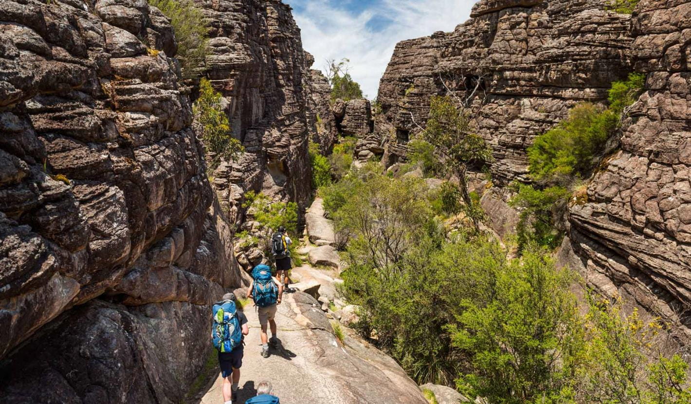
Trip Overview
Join us for a challenging 3-day (57 km) hike in the Grampians starting at the Gar Trailhead and finishing at Borough Huts.


Camping
We will be camping at Werdug (13 Sep) and Bugiga (14 Sep) Campgrounds. After your booking is approved by the leader please book your own campsite at the Park Victoria website https://bookings.parks.vic.gov.au/gpt-interactive-map-booker.
.
Itinerary and Walk Descriptions
Distance: 57 km
Elevation gain: 2,401 m
We will be starting at 7 am on Friday, 13 September, so it will be best if people arrive the night before. Unfortunately because of the long first day we will be unable to wait for latecomers. The night before we will agree on a car shuffle leaving some cars at the end of our walk, which is 36 km and a 37 minute drive from the start.
Transport
Transport to and from the walk location is by car. Please indicate your transport requirements and preferences on the booking request form when you book in.
If you don’t have a car, we can’t guarantee to provide you with a lift – this will depend on available drivers and their locations.
Passengers must pay the driver their share of car-pooling costs as described on the Car-pooling page. Please discuss the preferred method of payment with your driver.
Booking
Booking is required for this walk. Please indicate what similar walks you have done recently (that is, in the past few months) to give the leader confidence that you are capable of doing this hike. Refer to Walking Grades which, in conjunction with the walk description, will help you assess whether you have the required walking fitness and experience to do this walk.
The Leader will confirm your acceptance on the walk, or not, via email. The leader will provide details of where and when to meet.
By booking into this event you acknowledge that you agree to abide by our Code of Conduct.
Booking Fee:
Members: free. Non-members: $12.
Payment:
To avoid handling cash, non-members are required to pre-pay their booking fee by PayPal or credit/debit card.
Cancellation:
If you need to cancel, please advise the leader as soon as possible, so that someone else has the opportunity.
There will be no refunds, so please do not book unless you are fully committed to walking.
What to Bring
• All the equipment, clothing, food and water you will need for the walks and overnight stays (refer Trip details above).
Refer to our Gear Checklist page for more details, or discuss with the leader. If you are not properly equipped, the walk leader can decide not to let you participate on this walk.
Emergency Club Contact
The emergency club contact for this walk is Ken. The leader can provide you with the contact’s phone number, if you wish to pass this on to any friend/family member who may be concerned if you return late.
Safety and Ambulance Insurance
We strongly recommend that you have Ambulance cover. If conditions are hazardous, the walk may be cancelled. If any doubts at all, check your emails the night before and the morning of the event. For more details refer to: Joining a walk and your safety
If you are Covid-19 positive, have any Covid-19 symptoms or are a contact of someone with Covid-19, please follow the instructions in the Coronavirus Victoria website.
Still have questions?
Check out What happens on a walk.
Check out Weekend and extended walks.
Contact the leader using the “Enquiry” button.
Follow us on
Facebook: @YHABushwalkingClubVictoria
Instagram: @YHABushwalkingClub.
Members who wish to submit photos for social media or Yeti should refer to Member Resources.
Activity Date(s) |
|
|---|---|
Start: |
September 13, 2024 7:00 am |
End: |
September 15, 2024 3:00 pm |
Information |
|
Type: |
Pack-carry |
Grade: |
Hard |
Leader: |
Frank P |